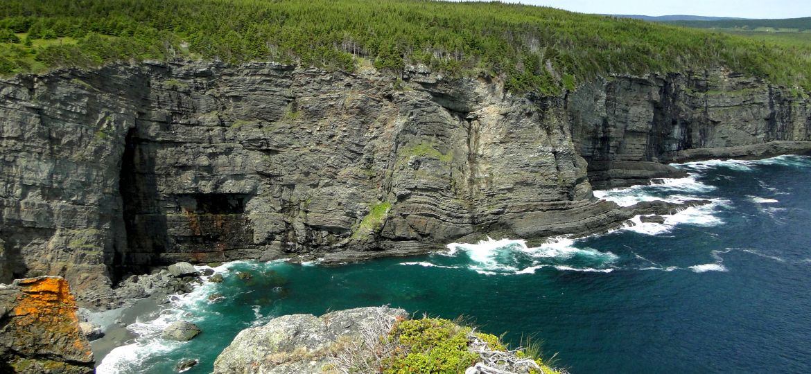
HURRICANE CHRIS HAS PASSED. ENJOY EAST COAST TRAIL AND REST OF NEWFOUNDLAND
Weather ALERT has been issued by Environment Canada on July 10th 2018 morning. The Statement reads:
Tropical Storm Chris is currently spinning off the Carolina coast and is expected to intensify to hurricane strength today. It will then begin to accelerate northeastward over the next several days and may track near the Avalon Peninsula as a post-tropical storm on Friday.

“Chris” which is a tropical storm right now with sustained wind speeds of 110 kph, spinning close to the South-Eastern United States in Carolina Coast, is expected to strengthen to a hurricane by tomorrow and will continue drafting North. Tropical Storms always try to curve as they move Northward. At the same time, it is always hard to say whether they will curve Westward to make a landfall or continue to move Eastward towards the sea, or when, or how sharply.
The direction is determined by the storm’s surrounding environmental flow and the conditions throughout the lower atmosphere, especially the meandering jet stream. However, what remains for certain is they tend to weaken as they move North due to cooler sea surface temperatures. They derive their energy from warm sea surface temperatures and evaporated moisture that forms the perfect recipe to sustain a storm, a combination that is missing in higher latitudes.
Once storms move north of Carolina Coast, they tend to drastically accelerate due to the area’s weather systems. A storm with a forward speed of 10 to 15 mph can accelerate to 20, 30 or even 50 mph in extreme cases.


Hurricane Chris will continue its NorthEastern draft through this week and will reach maximum intensity on Wednesday. It will begin to weaken after crossing the gulf stream due to the lower sea surface temperatures of Northern Atlantic. (Gulf Stream is a warm and swift Atlantic ocean current that originates in the Gulf of Mexico and stretches to the tip of Florida, and follows the eastern coastlines of the United States and Newfoundland before crossing the Atlantic Ocean)
It is unlikely that Chris will make a landfall on Eastern Coast of Nova Scotia. However, many forecasts suggest a certain landfall on the Avalon Peninsula with sustained wind speeds of 110-120 kph. The forward speed of Chris will stay higher and the storm shall pass in half a day.
It is strongly advised to avoid hiking East Coast Trail on Friday and Saturday. High wind speeds and rain will make sure of muddy trail, blowdowns, slippery rocks and you (or your stuff) being blown away. Those who seek rush in hiking during the storm, be mindful that your presence will only damage the trail and add on to a load of Search and Rescue team.

Keep following the Environment Canada Alerts for more information. The Alert by Environment Canada continues below.
1. Summary of basic information at 9:00 a.m. ADT.
Location: Near 32.7 North 73.5 West.
About 340 km southeast of Cape Hatteras.
Maximum sustained winds: 110 kilometres per hour.
Present movement: east-northeast at 6 km/h.
Minimum central pressure: 993 millibars.
2. Public weather impacts and warnings summary.
At this time the most likely land areas to receive direct impacts will be southeastern Newfoundland where Chris could make landfall as a post-tropical storm later in the week. Based on the current track, these areas could be impacted with heavy rain, strong winds, and heavy waves along parts of the coast. It is too to determine specific details at this time as there is still a wide possible range of track and intensity scenarios for Chris by that time. The Atlantic coast of Nova Scotia could receive some ocean swells and may possibly be brushed from some outer rainbands from Chris as it passes by to the south of that province.
a. Wind.
The most likely area for strongest winds from Chris will be over the Avalon Peninsula. Based on current track and intensity the likely range of maximum winds for these areas will be in the 80 km/h to 100 km/h range. However, it is too early to tell if wind warnings will be required given the current uncertainty in track and intensity.
b. Rainfall.
The greatest potential for heavy rainfall associated with Chris will be over southeastern half of Newfoundland and possibly over easternmost areas of Nova Scotia. If the current forecast track holds amounts in excess of 50 millimetres are possible with even higher amounts for Newfoundland. Rainfall warnings may be required later in the week for some areas.
c. Surge and waves.
High waves, pounding surf and storm surge will be a consideration for the southern coastlines of the Avalon Peninsula. Swells along the Atlantic Coast of Nova Scotia could reach 2 to 3 metres. For southern Newfoundland, of 4 to 6 metres are possible with potentially higher waves for parts of the Avalon Peninsula based on the current forecast track.
3. Marine weather impacts and warnings summary.
Storm and gale-force winds over portions of the offshore waters of Atlantic Canada will occur on Thursday or Friday. Hurricane-force warnings are likely for portions of the scotian slope waters south of Nova Scotia on Thursday. Significant wave heights for the southernmost waters south of Nova Scotia and Newfoundland could exceed 10 metres as indicated by wave height guidance.